• Skip to main content
  • Skip to primary sidebar

Diablo Green Consulting, Inc.

Environmental Services Professionals

  • Services
    • NEPA FCC & FAA Compliance for Wireless Towers
    • Outsourced Regulatory Compliance Services
    • Phase I ESA (Environmental Site Assessment)
    • Biological Surveys
    • Transaction Screen
    • Cultural Management
  • Contact
  • Terms of Service
  • Privacy Policy
  • Blog

Uncategorized

May 06 2024

What is a Transaction Screen Assessment

Transaction Screen Assessments (TSA) are streamlined investigations into a property’s potential environmental risks. They offer a cost-effective, preliminary look at the possibilities of contamination or past hazardous activities.

TSAs play a critical role in environmental due diligence for real estate transactions, providing an initial, time-sensitive evaluation of environmental liabilities attached to a property. This assessment helps buyers and lenders make informed decisions.

trees with a question mark in the middle to depict a question like when is a transaction screen assessment needed

When is a TSA advisable?

TSAs are particularly valuable for properties considered low-risk, such as undeveloped land or those with a primarily residential history. They are also ideal when time or budget constraints require a faster, less expensive alternative to a full Phase I ESA. It’s important to note that TSAs offer a preliminary assessment; a Phase I ESA provides a more comprehensive analysis.

The Transaction Screen Process

Records Review

The core of a TSA is a thorough review of records. Environmental professionals scrutinize historical land use, aerial photographs, regulatory permits, and environmental databases to identify any past activities that could raise environmental concerns. Public records searches can also reveal important details about past ownership and site usage.

Site Visit (Optional)

While not always included in a TSA, a site visit may be conducted if deemed necessary. This visit allows for a visual inspection, potentially identifying signs of environmental concern like unusual staining, chemical storage, or waste disposal areas.

Limitations of a Transaction Screen Assessment

Limited Scope

A TSA focuses on readily available records and may include a site visit. However, it lacks the in-depth research, interviews, and extensive on-site evaluations of a full Phase I ESA.

Potential for Overlooked Concerns

TSAs might miss environmental concerns that aren’t well-documented or visually obvious during a site visit. This could include subsurface contamination, historical hazards not evident in records, or improperly managed chemicals.

Not a Substitute for Phase I ESA in High-Risk Situations

For properties with a history of industrial use, known contamination issues, or those under strict regulatory requirements, a TSA might not be sufficient. A Phase I ESA provides the necessary depth for these scenarios.

man holding a stylus and a foreground of up arrow for quality and down arrow for cost

Benefits of a Transaction Screen Assessment

Cost-Effectiveness

TSAs offer a significantly more affordable approach to environmental due diligence compared to Phase I ESAs, making them a viable option when budget is a primary concern.

Time Efficiency

TSAs are typically completed much faster than full Phase I ESAs, providing quick insights for timely decision-making. This speed is especially beneficial when facing transaction deadlines.

Risk Identification

Even with limitations, a TSA can be highly effective in identifying major environmental red flags. This knowledge empowers buyers and lenders to make more informed choices, potentially avoiding costly surprises.

Appropriate for Low-Risk Properties

For properties like undeveloped land or those with residential histories, a TSA often provides sufficient information to confidently assess the level of environmental risk.

man holding a tablet and stylus

Transaction Screen Assessments: Your First Step in Environmental Due Diligence

Transaction Screen Assessments (TSAs) serve as a valuable initial step in the environmental due diligence process, particularly for low-risk properties and transactions constrained by time or budget. By providing a cost-effective and timely assessment of potential environmental concerns, TSAs help buyers, lenders, and other stakeholders make informed decisions about real estate deals.

It’s important to remember that TSAs have limitations compared to comprehensive Phase I ESAs. For higher-risk properties or situations requiring in-depth analysis, a Phase I ESA remains the most prudent choice.

If you’re considering acquiring a property, consulting with a qualified environmental professional is essential. They can advise you on the most appropriate assessment for your needs, whether that’s a TSA, a Phase I ESA, or a combination of approaches. By thoroughly understanding the potential environmental risks, you can move forward with confidence and minimize surprises in your real estate transactions.

Frequently Asked Questions About Transaction Screen Assessments

Can a TSA uncover environmental issues from a neighboring property?

Sometimes, but not always. A TSA will include a review of regulatory databases that may indicate past contamination on adjacent sites. However, if the neighboring property hasn’t been investigated or reported to regulatory agencies, the TSA might not capture potential concerns stemming from it. A visual site inspection, if included, could reveal some signs of off-site contamination impact, but more investigation might be needed.

How long does a TSA typically take?

The timeframe for a TSA can vary, but they are generally completed much faster than a Phase I ESA. Many TSAs are finalized within a few days to a week. Factors affecting the timeframe include the size and complexity of the property, the availability of records, and whether a site visit is included.

Do TSAs meet any specific lender requirements?

While some lenders might accept TSAs for lower-risk transactions, others may have stricter requirements and insist on a full Phase I ESA. It’s essential to consult with your lender early in the process to determine their specific environmental due diligence standards.

Can a TSA be upgraded to a Phase I ESA later?

Yes, in some cases. If a TSA raises concerns or if the transaction changes, it might be possible to expand the TSA into a full Phase I ESA. The environmental consultant can leverage the work already completed for the TSA, potentially streamlining the Phase I process.

What happens if a TSA identifies potential environmental risks?

A TSA revealing environmental red flags doesn’t necessarily mean the transaction can’t proceed. The next steps depend on the nature of the risk. Further investigation, like a Phase II ESA to analyze soil or groundwater, may be recommended. Alternatively, negotiations with the seller regarding cleanup responsibilities, price adjustments, or risk mitigation strategies might be necessary.
Written by Holly Moore · Categorized: Uncategorized

May 03 2024

Biological Survey Techniques

Imagine you’re exploring a new landscape. Biological surveys are the tools that turn a beautiful mystery into an understandable map, revealing the hidden patterns of the natural world.

This guide is designed for students, citizen scientists, and land managers ready to dive deeper into ecological surveys. We’ll assume you have a basic understanding of science, but we won’t leave you lost in jargon.

If you’ve ever wished the websites explaining survey techniques were more detailed, more realistic about the challenges, and just more helpful – you’re in the right place!

The Foundations of Biological Surveys

Biological surveys are systematic investigations designed to document the presence, distribution, or abundance of living organisms within a defined area. They differ from casual nature observations or simple species lists in three key ways:

  1. Purpose: Surveys are driven by specific questions or goals.
  2. Methods: They use standardized, repeatable techniques to ensure data quality.
  3. Scope: They focus on a defined area and timeframe.

The Goals of Surveys

Here’s where we broaden the typical lists found on other sites…

  • Conservation Planning: Identifying priority habitats, detecting rare or declining species, informing protected area design.
  • Land Management Decisions: Assessing the potential impacts of development, restoration projects, or changes in land use.
  • Basic Science: Documenting biodiversity patterns, tracking species range shifts (e.g., due to climate change), contributing to long-term datasets.
  • Education & Engagement: Citizen science surveys foster a connection to nature and can generate valuable data.
  • Legal Compliance Surveys are often required by environmental regulations.

Limitations

Let’s be honest – surveys aren’t magic. They can’t:

  • Tell us everything about an ecosystem (other types of research have their place too).
  • Detect super rare or cryptic species with 100% certainty.
  • Perfectly predict the future (but they equip us to make informed decisions).

A well-designed survey is a balance between getting the data you need and minimizing the effort and cost involved. No technique is perfect for every situation!

Essential Survey Techniques: A Focused Approach

We can’t cover every technique in depth, so we’ll zero in on methods that are versatile, relatively accessible, and teach core survey principles. Let’s focus on:

  • Quadrats: The foundation for sampling plants and less mobile organisms.
  • Transects: Great for examining patterns across habitat types or disturbance levels.
  • Point Counts: A standard method for bird surveys, adaptable to other wildlife.
  • Camera Trapping: A tech-forward tool with some caveats to discuss.

Quadrats: Getting Down to the Basics

  • Step-by-Step:
    • Choose Your Quadrat: Square is standard, but rectangular sometimes makes sense. Size matters! Smaller quadrats (1m x 1m) for abundant plants, larger (maybe 5m x 5m) for less common species.
    • Placement Strategy: Decide in advance – random for unbiased sampling, stratified to capture specific habitat zones…
    • Inside the Frame: Identify every plant species within, estimate percent cover (how much ground is obscured) if that’s your goal. For small insects, counting individuals may be possible.
  • Best For:
    • Plants and less mobile organisms (think snails, ground-dwelling insects).
    • Estimating percent cover of vegetation types (grasses, mosses, etc.).
    • Comparing sites with relatively uniform habitat.
  • Pros:
    • Simple equipment, minimal setup time needed.
    • Great for teaching core sampling concepts.
    • Data is easily analyzed using basic statistics.
  • Cons:
    • Can be time-consuming to survey large areas.
    • Not ideal for highly mobile animals or for studying cryptic species.

Transects: Unveiling Ecological Gradients

Step-by-Step:

  1. Define Your Transect: Imagine a straight line laid across your study area. It could be a physical line (tape measure) or imaginary – the key is consistency. Decide on its length based on the habitat and organisms you’re studying.
  2. Mark Your Path: Use flagging tape or markers to establish the transect line. Ensure you can relocate it precisely for repeat surveys.
  3. Data Collection: There are many ways to collect data along your transect, depending on your goals. Here are a few common approaches:
    • Distance Sampling: Measure the distance from the transect line to each individual or object you encounter (e.g., distance to bird sightings, distance to tree stems).
    • Point Intercept: At regular intervals (or continuous) along the transect, record the first plant species that touches a vertical pin dropped at that point.
    • Species Abundance by Interval: Divide your transect into smaller segments and record the number of individuals of each species observed within each segment.

Best For:

  • Studying how plant or animal communities change across environmental gradients (e.g., moisture levels, elevation).
  • Comparing habitats that are close together geographically.
  • Monitoring changes over time in response to disturbances or restoration efforts.

Pros:

  • Versatile – adaptable to a wide range of organisms and data collection methods.
  • Provides valuable data on both species presence and abundance.
  • Relatively simple to set up and implement.

Cons:

  • May miss species that are not easily detectable from the transect line (e.g., secretive animals).
  • Assumes a linear habitat – less suitable for highly complex or patchy environments.

Beyond Techniques: The Importance of Sampling Design

Even the best technique is useless if not deployed thoughtfully. Briefly cover:

  • Random Sampling: Ideal for unbiased results.
  • Stratified Sampling: Ensuring you capture variation within your study area.
  • Replication: It’s not just about the number of quadrats, but how they’re spread out.

Point Counts: A Snapshot of Bird Abundance (and More!)

  • Step-by-Step:
    • Choose Your Points: Select locations systematically or randomly across your study area, spaced far enough apart to avoid counting birds twice. Mark them with flagging or GPS for revisits.
    • Stand and Observe: For a set time (often 5-10 minutes), record all birds seen or heard within a fixed radius of your point. Estimate distances carefully to avoid over- or undercounting.
    • Notes Matter: Record weather conditions, time of day – these factors can influence bird activity.
  • Best For:
    • Assessing relative abundance and species richness of birds in a given area.
    • Tracking changes in bird communities over time (especially with repeated surveys).
    • With care, can be adapted to other vocal wildlife (frogs!) or even visual surveys in dense habitats.
  • Pros:
    • Relatively fast and simple to learn, making them good for citizen science.
    • Data can be compared across large-scale studies that follow similar protocols.
  • Cons:
    • Requires good bird identification skills, especially by sound.
    • May underestimate shy or quiet species.
    • Assumes birds are evenly detectable within your count radius, which may not hold true in dense foliage.

Camera Trapping: Wildlife Detectives

  • Step-by-Step:
    • Scout Your Site: Choose locations based on signs of animal activity (tracks, trails, scat) or to answer specific research questions about habitat use.
    • Setup: Mount the camera securely at the appropriate height and angle, aiming it carefully.
    • Settings: Decide on image/video mode, trigger sensitivity (avoid too many shots of waving grass!), and check battery life and SD card space.
    • Let it Work: Leave it undisturbed for a set period (weeks to months). Retrieve the camera and start analyzing the results!
  • Best For:
    • Documenting elusive or nocturnal animals.
    • Detecting rare species without intensive human presence.
    • Gathering long-term data on animal movement and behavior.
  • Pros:
    • Minimally invasive method, good for sensitive species.
    • Collects 24/7 data, even when you can’t be there.
    • Can be incredibly engaging for citizen science projects.
  • Cons:
    • Initial cost of cameras (though prices are dropping).
    • Risk of theft or damage in some areas.
    • Identifying animals from blurry photos can be challenging.
    • Image analysis can be time-consuming (but AI tools are emerging!)

Example: Designing a Bird Survey

Let’s say you’re concerned about how a new hiking trail might impact birds in a nearby forest. Here’s how the concepts from this section apply to designing a survey to address that question:

  • Objective: To compare bird diversity and abundance in areas close to the trail versus undisturbed forest.
  • Technique Choice: Point counts are likely a good fit here. They allow you to survey multiple locations within both the disturbed and undisturbed zones.
  • Sampling Design: You’ll use stratified sampling. Divide your study area into two zones:
    • “Trail Impact Zone”: Within a set distance of the trail (e.g., 50 meters on either side).
    • “Control Zone”: Areas of similar forest type, but further from the trail.
  • Placement: Randomly place point counts within each zone.
  • Replication: How many point counts are needed depends on the size of your study area and how much time you have. More is always better for reliable data!
  • Data Analysis Plan: You’ll likely focus on:
    • Species Richness: Total number of different bird species detected in each zone.
    • Relative Abundance: How common each species is, comparing between trail and control zones.

Important Considerations:

  • Time of Year: Bird populations change with the seasons, so conduct surveys at the same time in both zones.
  • Need More Expertise? If you want to estimate population sizes, or do complex statistical analysis, this might be a time to consult a professional.

Beyond the Field: Data Analysis & Interpretation

Making Sense of the Numbers

You’ve put in the hours counting, measuring, and observing in the field. Now, it’s time to turn those raw data points into meaningful insights. Let’s start with some basic descriptive statistics that can help you summarize key patterns:

  • Averages (Mean): Provides a snapshot of what was “typical” in your survey. For example, the average number of wildflowers per quadrat, or the average distance at which birds were detected.
  • Measures of Spread (Range, Standard Deviation): Tells you how much variation there was around the average. Was the number of plants roughly the same in all your quadrats, or were some overflowing while others were empty?
  • Species Richness: A simple but important metric – the total number of different species you detected. This gives a basic picture of biodiversity.

The Importance of Context

It’s tempting to stop there, but ecological data is most powerful when you consider the bigger picture:

  • Comparing to Past Data: Have similar surveys been conducted in your area before? If so, comparing your results to those studies can reveal important trends over time.
  • Habitat Matters: A forest and a meadow might have the same species richness, but that doesn’t mean they’re equally healthy. Link your survey data to observations about habitat quality (presence of invasive plants, signs of disturbance, etc.)
  • “Learn More” Links: Seasonal changes in weather, migration patterns, and other factors can influence your results. Provide links to resources that help your readers understand these potential influences.

Analysis: Leveled Up

Sometimes, you’ll want to dig deeper into your data. Acknowledge these more complex methods, but emphasize when it’s time to seek expert help:

  • Population Estimates: If your goal is to know the total number of individuals of a species in an area, techniques like mark-recapture come into play.
  • Statistical Tests: These help you determine if the differences you see between sites (e.g., higher bird diversity in one area vs. another) are likely real, or could just be due to random chance.

The Power of Visualization

A well-designed graph can make your findings instantly understandable. Even if you don’t create them yourself, consider including examples of how to visualize survey data:

  • Bar Graph: A great way to compare species richness or abundance between different habitats or survey locations.
  • Line Graph: Perfect for showing change over time, such as tracking how vegetation cover increases in a restoration area from year to year.

Ethical Considerations in Biological Surveys

Minimize Disturbance

Every survey has the potential to impact the organisms and habitats we’re studying. Discuss how to:

  • Choose the Right Techniques: Some methods are inherently more invasive than others (mist netting vs. visual surveys). Match the technique to the sensitivity of the species and the level of detail you need.
  • Tread Lightly: Minimize trampling vegetation off-trail, avoid handling wildlife unless absolutely necessary for the study, be aware of noise and light disturbance.
  • “Leave No Trace” for Scientists: Restore sampling sites as much as possible after your work (replace overturned rocks carefully, etc.)

Permitting & Regulations

  • Know the Rules: Research may require permits, especially for protected areas or work with endangered species. Link to the websites of relevant agencies in your region.
  • Ethics Beyond the Law: Sometimes, just because something is legal doesn’t mean it’s the right choice. Encourage readers to think critically about the potential impacts of their work.

The ‘Bigger Picture’ Angle

How can your survey data contribute to conservation in an ethical way?

  • Informing Management: Surveys done well can lead to better habitat protection, but only if the data is shared with the right people. Consider a short sidebar on how to find out who manages the land you survey.
  • Balancing Knowledge with Protection: Sometimes, publicly sharing the exact location of a rare species could put it at risk (poaching, etc.). Briefly discuss the concept of responsible data sharing.
  • When NOT to Survey: If a site is already heavily disturbed, or a population is extremely fragile, sometimes the best choice is to leave it alone.

Your Actions Matter

Surveys aren’t just about the data. They shape how you interact with the natural world. Encourage readers to:

  • Be Aware of Their Impact: Every footstep, every observation can have an effect.
  • Cultivate Curiosity and Respect: The best surveyors are motivated by a deep desire to understand nature, not just collect data points.

The Power of Informed Exploration

You now hold the keys to a deeper understanding of the natural world. Whether your surveys take you to a backyard, a vast national park, or somewhere in between, you’re equipped to ask better questions, collect meaningful data, and make informed choices.

Remember, the true scientist isn’t driven by just accumulating facts, but by a sense of wonder. Survey techniques are your tools,

Frequently Asked Questions About Biological Survey Techniques

Can I combine different techniques in a single survey?

Absolutely! In fact, it’s often the best approach. For example, imagine studying a restored meadow. You might use quadrats for detailed plant surveys, point counts to document bird recolonization, and camera traps to see which mammals are utilizing the area. Combining methods gives a multi-faceted view of ecosystem health.

What if I find something really unusual, like a species that shouldn’t be there?

Get excited, but proceed cautiously! First, double-check your identification (field guides, reliable online resources). If you’re confident, take clear photos for documentation. Then, contact experts. Local universities, natural history museums, or conservation agencies may be interested in confirming your find, especially if it’s a range expansion or an invasive species of concern.

The data analysis part seems overwhelming. Are there resources to help?

Yes! Start with simple spreadsheets for organizing your data. Many online tutorials exist for basic calculations (search terms like “biodiversity statistics tutorial”). For specific survey types, like bird point counts, there may even be standardized analysis tools freely available. Don’t hesitate to ask for help from more experienced scientists if you get stuck.

How long should a survey project last?

It depends entirely on your question! If you’re documenting what’s present right now, a single well-designed survey could suffice. To detect changes over time, repeat surveys are needed. These might be seasonal (tracking plant growth) or across multiple years (assessing long-term restoration success). The key is consistency in your methods.

Surveys seem focused on wild places. Can I do them in my urban neighborhood?

Definitely! Cities harbor surprising biodiversity. You might document which pollinators visit your community garden (visual surveys), how bird diversity changes across different park types (point counts), or use camera traps to see which critters use greenways at night. Urban surveys can even contribute to larger citizen science projects!

Written by Holly Moore · Categorized: Uncategorized

May 02 2024

Conservation Management Strategies

Imagine you’re a doctor treating a patient. A vague desire to “make them feel better” won’t cut it. Successful conservation is the same – it demands more than just wishing for healthy ecosystems. Strategic action is the prescription for lasting impact.

This guide is geared towards land managers, conservation practitioners, and students eager to move beyond theory into the messy, rewarding realm of making a real difference. We’ll focus on strategies for addressing widespread challenges like habitat loss and human-wildlife conflict.

Many websites list conservation strategies, but here we go deeper. You’ll learn how to match the right tool to the task, navigate the complexities influencing success, and know when to seek expert help. Think of this as your field manual for turning knowledge into effective action.

The Foundations of Effective Strategies

SMART Goals

Before you can pick the best strategy, you need a crystal-clear destination. SMART goals (Specific, Measurable, Achievable, Relevant, Time-bound) provide that roadmap. Don’t just aim for “more birds” – aim for “a 10% increase in grassland bird nesting success within 3 years.”

Beyond Just Biology

The most brilliant ecological strategy will fail if it doesn’t account for the human dimension. Will it require land-use changes? Could it impact livelihoods? Successful strategies consider the economic, social, and even political landscape of the project area.

“Adaptive Management” Buzzword Busting

This phrase gets thrown around, but what does it really mean? It’s about being flexible. Monitor your results, learn as you go, and don’t be afraid to change course if something isn’t working. Think of it as conservation with a feedback loop.

Strategies for Common Conservation Challenges

Invasive Species Control

Invasive species can wreak havoc on ecosystems, outcompeting native plants, degrading wildlife habitat, and even altering entire landscapes. Left unchecked, they can cause significant economic losses for landowners and harm the biodiversity we all depend on.

Strategies – Pros & Cons:

  • Mechanical Removal: This involves physically removing invasive plants through hand-pulling, digging, or mowing.
    • Pros: It’s a direct approach, requires minimal specialized equipment, and can be effective for small infestations or sensitive areas.
    • Cons: It can be extremely labor-intensive, especially for well-established invasives, and soil disturbance can sometimes encourage new weed growth.
  • Targeted Herbicides: Herbicides can be an efficient way to control large infestations of invasive plants.
    • Pros: They can work quickly and over broad areas.
    • Cons: There’s a risk of harming non-target plants or impacting water quality. Herbicide selection and application require careful consideration to minimize unintended consequences. Public opinion can also be a major hurdle for this strategy.
  • Biocontrol: This involves introducing carefully selected natural enemies (often insects or pathogens) of the invasive plant to suppress its population.
    • Pros: If successful, it can provide long-term, self-sustaining control.
    • Cons: It requires extensive research to ensure the biocontrol agent is safe and won’t negatively impact native species. This approach can take years to develop and may not be feasible for all invasive plants.

Mitigating Human-Wildlife Conflict

When humans and wildlife clash, it’s rarely a win-win situation. Animals can be injured or killed, people’s livelihoods (crops, livestock) may be damaged, and fear can erode public support for conservation. Finding solutions is essential for both wildlife wellbeing and healthy human communities.

Strategies – Tailored Solutions:

  • Non-Lethal Deterrents: These can range from simple (fences, noisemakers, bright lights) to high-tech (livestock guardian animals, even drones!).
    • Pros: Focus on changing animal behavior, can sometimes be a quick fix.
    • Cons: Animals may adapt, effectiveness varies by species, and solutions need to be practical for people to use consistently.
  • Compensation Schemes: Reimbursing farmers for livestock losses, or proactively paying for practices that reduce conflict (elephant-proof fencing…), can offset the costs people bear.
    • Pros: Acknowledges the economic reality, can improve tolerance for wildlife presence.
    • Cons: Requires funding, must be well-monitored to avoid fraud, and doesn’t always change the root cause of the conflict.
  • Community-Based Solutions: These put local people at the forefront of managing the wildlife they live alongside.
    • Pros: Builds local ownership, solutions are more likely to be sustainable long-term.
    • Cons: Requires outside expertise (often from NGOs) to set up, and addressing deep-seated conflicts takes time.

Habitat Fragmentation

When once-continuous landscapes are divided by roads, development, or agriculture, it’s bad news for many species. Small, isolated populations are vulnerable to inbreeding, local extinctions, and can’t adapt to change (like shifting climate patterns). Habitat connectivity is key to long-term resilience.

Strategies – Reconnecting the Landscape:

  • Wildlife Corridors: These protected strips of land allow animals to move safely between fragmented habitats.
    • Pros: Can facilitate range shifts, boost genetic diversity… nature does the work! 
    • Cons: Requires buy-in across large areas, potential highway mortality, and may not be enough for highly sensitive species.
  • Restoration on Private Lands: Even small-scale habitat creation on working farms or in suburban yards contributes to connectivity.
    • Pros: Empowers individual action, incentive programs can make it financially viable for landowners.
    • Cons: The ‘stepping stone’ approach may not be sufficient for the needs of all species.
  • Land Acquisition or Conservation Easements: Securing key parcels to prevent future development maintains crucial links in the habitat chain.
    • Pros: Provides the most lasting protection.
    • Cons: Often the most expensive option, and requires identifying the highest priority areas.

From Plans to Action

Funding the Work

  • Grants as a Lifeline
  • Beyond the Big Names
  • Realistic Budgets

Community as Partners

  • The Power of People: Success is rarely achieved by lone conservation heroes. From volunteer workdays to citizen science data collection, tap into the public’s desire to help.
  • Co-management Models: Highlight projects where decision-making is truly shared with Indigenous communities or other local stakeholders. This builds long-term support.
  • “Not Just About Warm Fuzzies”: Community engagement can also be a source of essential local knowledge and reduce long-term management costs.

The Monitoring Gap

  • Why It’s Not Optional: Too many projects fizzle out, not from failure, but from never knowing if they worked! Explain this in plain terms.
  • Simple IS Powerful: Metrics don’t have to be complex to be useful. Examples: Bird surveys before/after restoration, photo monitoring points, landowner interviews for conflict reduction projects…
  • Data as Your Story: Monitoring results are essential for securing future funding and refining your strategies.

When to Call in the Experts

Knowing Your Limits

  • Honesty is Strength: It’s not a sign of weakness to admit when you’re out of your depth. The wrong decision made with “good intentions” can do more harm than good.
  • Complexity is Real: Mention a few scenarios: large-scale population modeling for setting harvest quotas, designing surveys with statistical rigor, navigating complex environmental regulations… things beyond the self-taught skillset.

Finding the Right Help

  • Tap Your Network: University researchers, staff at conservation NGOs, or government agencies may be willing to advise or collaborate.
  • Professional Consultants: Especially helpful for time-bound projects with specific needs (designing a statistically robust monitoring program, for example).
  • Directories Matter: Link out to directories of conservation consultants, or relevant professional societies where members may advertise expertise.

Your Conservation Journey Starts Here

You now have the tools to turn ecological knowledge into strategic action. Remember, conservation success isn’t about having all the answers from day one. It’s about a commitment to informed decision-making, building partnerships, and being willing to adapt along the way.

Whether you’re tackling a stubborn invasive plant, seeking coexistence with wildlife, or restoring a fragmented landscape, this guide has been your trail map. The journey may be long, but every step makes a difference.

Frequently Asked Questions About Conservation Management Strategies

I don’t have a science degree. Can I still be effective in conservation?

Absolutely! Conservation needs people with diverse skills. From communicating with the public, to fundraising, to negotiating land deals, there are countless ways to make a difference. The passion to learn and a willingness to collaborate are often more important than any specific diploma.

How do I set SMART goals when there’s so much uncertainty?

Focus on what you CAN control. You may not be able to predict rainfall, but you can aim for “planting X number of native trees by Y date.” Adaptive management means your goals can evolve, but starting with a clear direction is key.

“Community engagement” sounds messy. Isn’t it faster to just do it myself?

Sometimes, but not in the long run. Projects done to a community rarely last. By investing time upfront in building trust and incorporating local needs, your work is more likely to be protected and maintained for years to come.

I’m a student with no budget. What can I do?

Your time and knowledge are valuable! Volunteer for habitat restoration workdays, help monitor a local project, or use your skills (writing, web design, etc.) to support a small conservation organization. These experiences build your network for future opportunities.

I tried a strategy from my textbook and it failed. What now?

First, you’re not alone! Ecology is complex. Analyze WHY it might have failed (too small scale, didn’t address the main threat…), then either adapt your approach or seek advice from someone with experience tackling similar challenges. Failure is how we learn what works in the real world.

Written by Holly Moore · Categorized: Uncategorized

May 01 2024

Ecological Regions (Ecoregions)

Imagine hiking through a lush rainforest, the air heavy with moisture, then traversing vast, sunbaked desert dunes. Earth’s landscapes may seem wildly diverse, but there’s a hidden pattern to the planet’s natural tapestry. Ecoregions are the key to decoding this beautiful complexity.

While you might hear terms like “biome” or “ecological zone,” we’ll mainly use the term “ecoregion.” These all describe similar concepts – areas defined by their unique combination of climate, geology, plants, and animals.

Understanding ecoregions takes you beyond simply memorizing places on a map. You’ll discover what makes each region special, why these divisions matter for conservation, and how the science of ecoregions can even enhance your next adventure. Let’s dive in!

What Are Ecoregions? Beyond the Map

Ecoregions are areas with distinct combinations of plants, animals, and landscapes. Think of them as nature’s neighborhoods, each with its own unique character.

Several factors work together to shape an ecoregion:

  • Climate: Temperature and rainfall patterns play a huge role. Compare the steamy Amazon rainforest to the frigid Arctic tundra.
  • Geology: The underlying rock and soil types influence what plants can grow, and the terrain itself (think mountains vs. flat plains).
  • Wildlife: Animals have evolved to thrive in specific conditions, so a region’s plant life determines which animal communities you’ll find.
  • Human Influence: While not a natural factor, how people use the land leaves its mark, and is increasingly considered in ecoregion definitions.

Ecoregions exist at different scales. There are massive continental ecoregions, but even your backyard is likely part of a more localized ecoregion with its own distinct flavor.

Ecoregions in Action

Conservation Corner

Ecoregions are a conservationist’s best friend. They help identify which areas are most diverse or in need of protection. For example, the Cape Floristic Region in South Africa is famed for its unique plant life found nowhere else. Recognizing it as a distinct ecoregion was crucial for getting it protected.

Travel with an Eco-Lens

Understanding ecoregions makes you a more mindful traveler. Resources like WWF’s “Wildfinder” let you explore ecoregions around the globe. Before your next trip, research the region’s wildlife – it’ll make your experience so much richer!

DIY Science?

Ecoregions are a great way to get involved in citizen science. Document the plants and animals you see in your neighborhood using apps like iNaturalist. Your observations contribute to our understanding of biodiversity at a local scale, and might even help track changes in your own ecoregion over time.

Not sure which ecoregion you’re in? Several websites let you type in your location and discover its ecological classification. It’s a fun starting point for learning more!

The Ecologist’s Toolkit

How are ecoregions mapped?

It’s a mix of high-tech tools and boots-on-the-ground science:

  • GIS (Geographic Information Systems): Think of it as digital mapmaking on steroids. Ecologists layer data on climate, vegetation patterns, satellite images, you name it! Analyzing these layers helps them draw ecoregion boundaries.
  • Remote Sensing: Satellites provide a bird’s-eye view of things like land cover changes or temperature patterns over vast areas. Essential data for those mapping global ecoregions.
  • Fieldwork: Nothing beats seeing it for yourself! Ecologists collect on-the-ground data about plant and animal communities, soil samples, etc. This verifies what the maps suggest and refines those ecoregion lines.

Ecoregions aren’t set in stone. Where one ends and another begins can be fuzzy, and scientists sometimes disagree on the precise boundaries. It’s a reminder that classifying nature will always have an element of human interpretation.

“Want to Be an Ecologist?”

If maps, data analysis, and fieldwork pique your interest, there are careers dedicated to ecoregion science! From conservation organizations to government agencies, understanding ecoregions is a valuable skill set.

Digging Deeper

Explore the World (of Ecoregions)

The World Wildlife Fund’s ecoregion list is a fantastic starting point. Browse by region, or search for a specific place you’re curious about.

Ecoregions Near You

The EPA (if relevant to your location) may have detailed ecoregion maps and information specific to your area.

Learn from the Experts

Many universities have strong ecology or environmental science programs. Check their websites for research projects related to ecoregions, often with fascinating local or regional case studies.

Glossary Box

Let’s demystify some common ecology terms:

  • Biome: A very broad category based mainly on climate and dominant vegetation (e.g., desert biome, tropical rainforest biome).
  • Biodiversity: The variety of life in a given area – could be the number of different species, or go deeper into genetic diversity.
  • Ecosystem: A community of living organisms interacting with their physical environment (a forest, a pond, even your gut microbiome are examples!)
  • Ecozone: Sometimes used as a synonym for ecoregion, but technically it’s an even broader level of classification. There are only a handful of continental-scale ecozones globally.
  • Endemic: A species found only in one specific region and nowhere else on Earth.
  • Habitat: The natural home of a plant or animal, providing everything it needs to survive.
  • Indicator Species: A plant or animal whose presence, abundance, or health tells scientists a lot about the overall condition of an ecoregion.
  • Keystone Species: A species that plays an outsized role in shaping its ecosystem. Understanding a region’s keystone species is essential for conservation within that ecoregion.
  • Range: The geographic area where a species naturally occurs. An ecoregion may encompass the entire range of some species, or only a portion of the range for more widespread species.
  • Restoration Ecology: The science of repairing damaged ecosystems. Ecoregion classifications are often used to guide restoration goals, aiming to return a degraded area to its original ecoregion type.

The Power of Ecoregions

Whether you’re exploring your own backyard or a far-flung corner of the globe, ecoregions help you understand the interconnectedness of life. They remind us that each piece of this planet’s complex puzzle has its own value and plays a role in the larger story.

By learning about ecoregions, you gain more than just knowledge. You become a steward of the natural world, equipped to make informed choices about conservation, travel, and even the plants in your garden.

Frequently Asked Biological Zones (Ecoregions)

How do ecoregions relate to climate change?

Ecoregions are both affected by climate change and tools for understanding its impact. Shifts in temperature and rainfall are altering habitats within ecoregions, sometimes pushing species beyond their limits. Ecologists track these changes to predict which ecoregions are most vulnerable, guiding conservation efforts.

Are all ecoregion classifications the same?

No! Different organizations (WWF, EPA, etc.) may have slightly different ecoregion maps, especially at local scales. There’s no single “right” way to divide nature. The important thing is using a consistent classification for a given project.

Can ecoregions change over time?

Absolutely! They can change due to natural forces (long-term climate shifts, major disturbances), but increasingly due to human actions. A region heavily impacted by deforestation or urbanization may be reclassified to reflect its altered state.

My region has sub-ecoregions. How do those fit in?

Ecoregions are hierarchical! Large ecoregions contain smaller, nested ones, each with finer-grained distinctions. Think of it like zooming in: Global ecoregion -> Continental -> State-level -> Your unique local patch.

Do ecoregions have sharp boundaries?

Rarely! Nature doesn’t work in straight lines. Ecoregions often have transitional zones (ecotones) where characteristics of adjacent regions blend. This fuzziness is where biodiversity can be especially rich and interesting to study.

Written by Holly Moore · Categorized: Uncategorized

Apr 29 2024

What is the Endangered Species Act?

The Endangered Species Act (ESA) is one of the United States’ most powerful environmental laws. Enacted in 1973, its core purpose is to prevent the extinction of our nation’s most imperiled plants and animals. It does this through two main ways:

  • Identifying and Protecting: The ESA establishes a process to scientifically assess species at risk and list them as either “endangered” or “threatened.”
  • Mandating Recovery Actions: Once listed, the ESA requires federal agencies and partners to develop and implement plans to help these species recover.
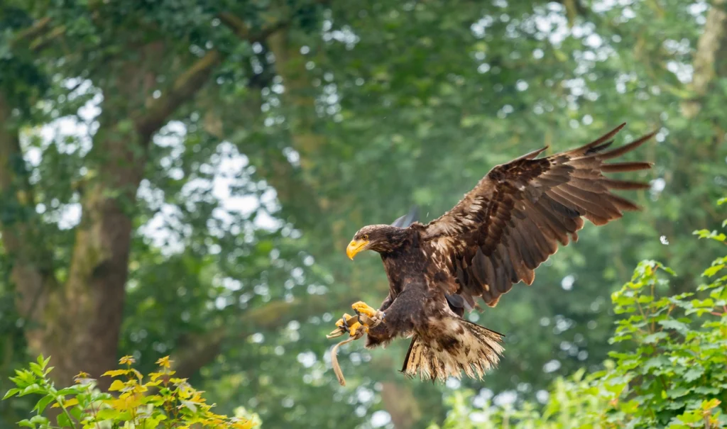
an eagle, a part of animals in the endangered species act, flies across trees

Why ESA Matters

The ESA acts as a crucial safety net for species on the brink. Protecting endangered species is essential for several reasons:

  • Biodiversity: Each species plays a role in the healthy functioning of ecosystems. Loss of species disrupts this delicate balance.
  • Intrinsic Value: Many believe all species have the right to exist, regardless of their direct benefit to humans.
  • Potential Benefits: Species offer potential undiscovered resources like medicines or unique adaptations that could inspire technology.

A Milestone in Conservation

The ESA was a landmark piece of legislation, recognizing that humans have a responsibility to prevent the irreversible loss of the natural world. It stands as a testament to the power of collective action to safeguard the planet’s incredible biodiversity.

Key Components of the ESA

Listing Species

  • ‘Endangered’ vs. ‘Threatened’
    • Endangered: A species in immediate danger of extinction throughout all or most of its range.
    • Threatened: A species likely to become endangered in the foreseeable future.
  • How Species Get Listed
    • Scientific Assessment: Biologists with the U.S. Fish and Wildlife Service (FWS) or National Oceanic and Atmospheric Administration (NOAA) Fisheries conduct rigorous assessments of a species’ status.
    • Public Petitions: Citizens or organizations can also petition to have a species considered for listing.

Protecting Listed Species

  • Prohibitions The ESA makes it illegal to harm, harass, capture, or trade listed species. Examples:
    • Killing an endangered animal, even accidentally.
    • Selling products made from threatened plant parts.
    • Disrupting the nesting behavior of protected birds.
  • Habitat Protection:
    • Critical Habitat: Areas essential for a species’ survival are designated, receiving added legal protection. Activities that damage these areas can be restricted.
  • Recovery Plans:
    • These are the blueprints for recovery, outlining goals, actions needed, and timelines for bringing a species back to a healthy population level.

The Role of Agencies

  • U.S. Fish and Wildlife Service (FWS): Primarily responsible for terrestrial and freshwater species.
  • National Oceanic and Atmospheric Administration (NOAA) Fisheries: Oversees marine species and anadromous fish (like salmon that migrate between rivers and the ocean).
a butterfly in a field signifying biodiversity

Successes and Challenges

The Impact of the ESA

  • Preventing Extinctions: The ESA has played a vital role in preventing numerous extinctions. Without it, we might have lost iconic species like the bald eagle or the gray wolf.
  • Recovery Stories: Several species have rebounded enough to be delisted, including the American alligator and Louisiana black bear.
  • Ecosystem Protection: By safeguarding endangered species, the ESA often benefits entire ecosystems as habitats are protected or restored.

Ongoing Debates

  • Economic Impacts: Restrictions to protect listed species or their habitat can sometimes create conflicts with development or industry interests, leading to legal battles.
  • Listing Process: Some argue the process for listing a species can be too slow, failing to protect species quickly enough to prevent further declines.
  • Balancing Interests: Finding the balance between economic activities and species protection is an ongoing challenge and source of debate.

While the ESA faces challenges, it remains a powerful tool for conservation. Continuous evaluation and efforts to improve its effectiveness are crucial for ensuring its long-term success.

The ESA and Global Conservation

While the ESA focuses primarily on species within the United States, it plays a role in broader international conservation efforts. A key way this occurs is through its connection with CITES.

Connection to CITES (Convention on International Trade In Endangered Species of Wild Fauna and Flora):

  • CITES: This international treaty regulates the trade of endangered and threatened species across borders, with over 180 member countries.
  • How They Work Together:
    • Complementary protection: Species listed under CITES often receive added safeguards within the U.S. if they are also listed under the ESA.
    • Combating Illegal Trade: The ESA’s strict import/export regulations help enforce CITES provisions, preventing the trafficking of endangered animals and plants.

Example: A parrot species listed as Endangered under the ESA and Appendix I of CITES (most restrictive trade category) would be very difficult to legally import into the U.S. or sell commercially.

The ESA helps strengthen the global network of laws protecting endangered species and contributes to coordinated international efforts to fight wildlife trafficking.

skeletons of a t-rex to depict extinction of a species

How You Can Get Involved

The Endangered Species Act isn’t just about government action – here’s what individuals can do:

Support Conservation Organizations

  • Find reputable organizations: Research their work and focus areas. Check out websites like Charity Navigator for ratings and reviews.
  • Donate or Become a Member: Your support funds legal defense of the ESA, endangered species research, habitat protection, and advocacy.

Responsible Choices

  • Sustainable Products: Opt for eco-friendly products and minimize single-use plastics that end up in waterways and oceans.
  • Wildlife-Friendly Habits:
    * Avoid pesticides harmful to insects and the birds that depend on them.
    * Keep cats indoors to protect vulnerable bird species.
  • Reduce Your Impact: Conserve energy and water, and consider sustainable transportation choices.

Stay Informed

  • Reliable Sources:
    • U.S. Fish & Wildlife Service and NOAA Fisheries.
    • Reputable Conservation Organizations: Often provide action alerts, updates on the ESA, and species spotlights.

Every action, big or small, makes a difference. By supporting conservation, making informed choices, and spreading awareness, you can help ensure the Endangered Species Act continues to protect our most vulnerable wildlife for generations to come.

The Enduring Legacy of the ESA: A Call to Action

The Endangered Species Act stands as a powerful testament to our nation’s commitment to protecting its natural heritage. While it faces ongoing challenges, the ESA has proven to be an essential tool in preventing extinctions and inspiring incredible recovery stories. Its success depends not only on government agencies but also on the actions of everyday citizens.

By supporting conservation organizations, making responsible choices, and staying informed, each of us plays a crucial role. Whether it’s ensuring a brighter future for an iconic species or protecting a lesser-known but equally vital part of our ecosystem, your actions contribute to a healthier planet.

The Endangered Species Act embodies the belief that all species deserve a chance to thrive. Let’s continue working together to uphold this vital law and create a world where biodiversity flourishes for generations to come.

Frequently Asked Questions About Endangered Species Act

How many species are currently protected under the ESA?

The exact number fluctuates, but there are over 1,600 species listed as either endangered or threatened under the ESA within the U.S. Additionally, several hundred foreign species receive protection due to their endangered status internationally.

I’ve heard about “delisted” species. Does that mean the ESA failed?

Absolutely not! Delisting a species usually indicates a major success story. It means that due to conservation efforts, the species has recovered to the point where it no longer meets the criteria for being endangered or threatened. Famous examples include the Bald Eagle and the Gray Wolf.

Can I visit habitats of endangered species?

Sometimes! Many national parks, wildlife refuges, and conservation areas offer opportunities to responsibly observe wildlife, including some endangered species. However, it’s crucial to follow all regulations and respect sensitive areas designated for the species’ protection.

Can businesses or development projects still happen if endangered species are present?

Potentially yes, but with careful planning. The ESA doesn’t ban all development in areas with endangered species. Instead, it requires consultation with wildlife agencies to find ways to minimize harm or offset the project’s impact through mitigation measures.

Is the ESA only for well-known animals like pandas and tigers?

Definitely not! The ESA protects a wide range of species, including many lesser-known plants, insects, fish, and even mussels. These less charismatic species often play critical roles in their ecosystems that benefit us in numerous ways.

Written by Holly Moore · Categorized: Uncategorized

  • « Go to Previous Page
  • Go to page 1
  • Go to page 2
  • Go to page 3
  • Go to page 4
  • Go to page 5
  • Interim pages omitted …
  • Go to page 12
  • Go to Next Page »

Primary Sidebar

Recent Posts

  • Diablo Green and Tullup Parntership
  • What is in a Transaction Screen Assessment Report?
  • ASTM Transaction Screen (TSA)
  • Environmental Transaction Screens
  • Transaction Screen Assessments: What to Expect

Categories

  • Uncategorized

Archives

  • August 2024
  • May 2024
  • April 2024
  • March 2024
  • February 2024

Copyright © 2025 · Diablo Green Consulting, Inc.