• Skip to main content
  • Skip to primary sidebar

Diablo Green Consulting, Inc.

Environmental Services Professionals

  • Services
    • NEPA FCC & FAA Compliance for Wireless Towers
    • Outsourced Regulatory Compliance Services
    • Phase I ESA (Environmental Site Assessment)
    • Biological Surveys
    • Transaction Screen
    • Cultural Management
  • Contact
  • Terms of Service
  • Privacy Policy
  • Blog

Holly Moore

May 08 2024

What is the Process of a Record Search With Risk Assessment (RSRA)?

A Records Search with Risk Assessment (RSRA) is a desktop study, examining historical records and government databases to identify potential environmental concerns associated with a property.  RSRAs are often used for initial screening to gain insights into a property’s history.

SBA Connection: The Small Business Administration (SBA) frequently utilizes RSRAs as a way to meet environmental due diligence requirements for its loan programs. RSRAs offer a streamlined and cost-effective method of environmental assessment.

a man holding a stylus and tablet to depict following the rsra process

The RSRA Process: A Step-by-Step Guide

Database Research

  • Federal Databases:
    • National Priorities List (NPL): Identifies Superfund sites, the nation’s most contaminated properties requiring long-term remediation.
    • Resource Conservation and Recovery Act (RCRA): Lists facilities that generate, transport, treat, store, or dispose of hazardous waste.
    • Brownfields: Properties with known or suspected contamination, potentially eligible for redevelopment grants.
    • Other databases may include those tracking leaking underground storage tanks (LUSTs) or sites with institutional controls.
  • State & Local Databases:  State and county-level environmental agencies often maintain their own databases that complement federal listings.  These might include:
    • State-equivalent Superfund sites
    • Registered underground storage tanks (USTs) and leaking UST sites.
    • Landfills
    • Lists of known or potential contaminated properties
    • Records of spills, releases, or enforcement actions
  • Purpose: Database searches focus on identifying past or present activities at or adjacent to the property, potentially raising concerns about soil, groundwater, or vapor intrusion issues. Red flags include past industrial use, dry cleaners, gas stations, auto repair facilities, or proximity to known contaminated sites.

Historical Records:

  • Fire Insurance Maps: These maps were designed for fire insurance underwriting and often depict building footprints, street layouts, and past land uses. Clues to potential environmental concerns include the presence of manufacturing facilities, chemical storage areas, or fuel tanks.
  • Aerial Photographs: Historical aerial photos offer snapshots of the property and surrounding areas over time. Changes in land use, the appearance of stockpiles, disposal areas, or industrial structures can suggest potential sources of contamination.
  • City Directories: These directories provide a reverse-lookup of businesses associated with a specific address. Identifying past occupants operating in environmentally sensitive industries can highlight areas for further scrutiny.

Environmental Questionnaire

This questionnaire, typically completed by the property owner or occupant, gathers information not readily available in records. Questions might address:

  • Current and previous uses of the property
  • Storage and handling of hazardous chemicals or petroleum products
  • Presence of underground or aboveground storage tanks
  • Waste disposal practices
  • Past spills, releases, or environmental concerns

Risk Determination

The environmental professional carefully reviews all the information gathered. They use their expertise to assess the potential for environmental contamination based on past property uses, findings from database searches, clues from historical records, and any disclosures in the environmental questionnaire.  The property then typically receives a “Low” or “High” environmental risk classification.
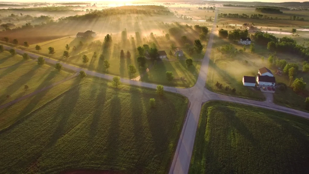
vacant residential lots that are common in RSRAs

Real-World Implications of an RSRA

Example 1: “Low Risk” Finding:

Consider a scenario where the property in question is a vacant lot historically used for residential purposes. The RSRA reveals no concerning entries in databases and historical records support the consistent residential use. In this case, a “Low Risk” finding allows for a smoother transaction. Lenders might accept this level of due diligence, especially for SBA loans.  Buyers can proceed with greater confidence that the likelihood of hidden contamination is low.

Example 2: “High Risk” Finding:

Imagine the RSRA uncovers that the property was formerly a dry cleaning facility. Dry cleaners often used hazardous chemicals that can persist in soil and groundwater.  This finding would likely trigger a “High Risk” classification, indicating a Phase I ESA is necessary.  The Phase I ESA, with its site visit and potential sampling, would provide a more comprehensive analysis to identify any contamination and determine its extent.

Beyond the Examples:

It’s important to note that not all “Low Risk” findings lead to immediate transactions, and not all “High Risk” findings mean a deal is dead.  Here’s why:

  • “Low Risk” with Further Action: Even with a “Low Risk” finding, a buyer or lender may opt for a limited Phase I ESA or additional investigation if something in the RSRA raises a minor concern.
  • “High Risk” Next Steps: A “High Risk” finding gives the buyer leverage to negotiate remediation costs with the seller or strategize risk mitigation, such as environmental insurance. They may decide to proceed with the transaction if the other aspects are favorable.
hand holding a pen. 3 green arrows pointing upwards for quality, speed, and efficiency, and 1 downwards for cost

Why Conduct an RSRA?

Cost & Time Savings

RSRAs offer significant savings in both cost and time compared to full Phase I ESAs. This makes them especially attractive for smaller transactions, properties deemed low-risk, and scenarios where decisions need to be made quickly.

Informed Decision-Making

Even with its limitations, a well-conducted RSRA provides valuable information about a property’s environmental history. This knowledge empowers buyers and lenders to make informed decisions, even in the early stages of a potential transaction.  Here’s how:

  • Low-Risk Confidence: A thorough RSRA with no red flags offers greater confidence in proceeding with a low-risk property.
  • Risk Identification: An RSRA can quickly identify potentially significant environmental concerns, allowing buyers to reevaluate the transaction or negotiate early on.
  • Guidance for Next Steps: The RSRA results inform whether to proceed confidently, terminate the deal, or initiate a more comprehensive Phase I ESA.

Specific Benefits for SBA Loans

RSRAs align well with the requirements of the Small Business Administration’s lending programs. Often, an RSRA can satisfy environmental due diligence for SBA loans, simplifying and expediting the process for small businesses seeking financing.

Limitations of the RSRA

No Site Visit

As a purely records-based assessment, the RSRA cannot uncover environmental concerns that might be visually apparent on a site inspection. This includes:

  • Improperly stored chemicals or containers
  • Stained soil or unusual odors
  • Evidence of stressed vegetation
  • Potential illegal dumping areas

Potential for Missed Concerns

Contamination may exist from undocumented activities,  illegal practices, or historical events not reflected in standard databases or records.  Situations that might be missed include:

  • Localized contamination or small spills not reported to authorities
  • Improper past waste disposal practices leaving no paper trail
  • Contamination migrating from an off-site source that wouldn’t appear in typical database searches

Importance of the Environmental Professional

The quality and thoroughness of an RSRA heavily depend on the expertise of the environmental professional conducting it. A poorly executed RSRA might miss crucial details or fail to appropriately analyze the data.

It’s essential to understand that an RSRA does not offer the same level of assurance as a Phase I ESA. Recognizing these limitations is crucial for making informed risk-based decisions in real estate transactions.

The Power of RSRAs: Informed Real Estate Decisions

RSRAs play a valuable role within the broader spectrum of environmental assessments for real estate transactions.  While they have limitations and shouldn’t be considered a substitute for a Phase I ESA in high-risk situations, RSRAs offer a streamlined and cost-effective way to gain a preliminary understanding of a property’s potential environmental liabilities.

When used appropriately, RSRAs empower buyers, lenders, and small businesses to make informed decisions, expedite transactions for low-risk properties, and strategically navigate environmental due diligence requirements. Consulting with a qualified environmental professional is crucial to ensure a well-executed RSRA and to properly interpret the findings for your specific real estate needs.

Frequently Asked Questions About RSRAs

My property is a small residential lot. Is an RSRA enough, or do I need a Phase I ESA?

An RSRA might be sufficient initially, especially if it reveals a consistent history of residential use with no red flags in the records or historical documents.  Many lenders accept RSRAs for such properties, and especially for SBA loans.  However, if anything in the RSRA raises even slight concerns, a limited Phase I ESA might be prudent for greater peace of mind.

The RSRA shows the neighboring property was a gas station. Should I be worried about contamination on my property?

Yes, this is a valid concern.  Depending on factors like the distance between the properties, groundwater flow direction, and the nature of operations at the former gas station, there’s a potential for contamination to have migrated onto your property. In this scenario, while an RSRA raises the red flag, a Phase I ESA would be recommended for a more thorough assessment.

I need to make a quick decision on a property. How long does an RSRA take?

One major advantage of RSRAs is their speed.  While turnaround time depends on the complexity of the property and availability of records, many RSRAs can be completed within a few days to a week.  This is significantly faster than a Phase I ESA.

I’m not getting a loan, but I’m concerned about the long-term costs of potential cleanup.  Is an RSRA worth the investment?

Absolutely.  Even without a lender involved, an RSRA offers a cost-effective way to gain insights into a property’s history. If the RSRA suggests low risk, you can proceed confidently. If it reveals potential environmental issues, you can negotiate with the seller over responsibility for further investigation or remediation before closing the deal.

What exactly does the environmental professional look for when conducting an RSRA?

Environmental professionals conducting RSRAs meticulously examine:

  • Databases: They search for any records of spills, releases, permitted facilities, Superfund sites, etc., on or near the property.
  • Historical Records: Fire insurance maps, aerial photographs, and city directories can reveal past uses that might have left contamination.
  • Environmental Questionnaire: This helps uncover information about the property’s history that might not be in readily available records.

Written by Holly Moore · Categorized: Uncategorized

May 07 2024

Phase 1 ESA vs. Transaction Screen Analysis

Real estate transactions can harbor hidden environmental hazards, from buried fuel tanks to lingering chemical contamination. Overlooking these risks can lead to costly cleanups, legal battles, and plummeting property values.  Environmental due diligence like a TSA is your shield against unforeseen liabilities.

  • Phase 1 Environmental Site Assessment (ESA): A comprehensive investigation that delves into a property’s potential environmental contamination risks, often in accordance with the ASTM E1527 standard.
  • Property Transaction Screen Analysis (TSA): A preliminary assessment focusing primarily on readily available records, designed to reveal potential environmental risks.

Selecting the right type of environmental assessment—a Phase 1 ESA or a TSA—is crucial. This choice directly impacts your financial risk, legal protection, and ability to make informed decisions in real estate transactions.

a forest with a check in the middle to depict a TSA checklist

Key Differences: Understanding the Dissimilarities

CategoryPhase 1 ESATSA
Scope of AssessmentExtensive, includes historical research, interviews, in-depth site visitPrimarily record-based, may include limited site visit
Liability ProtectionCan qualify for CERCLA Innocent Landowner DefenseMight not offer the same legal protection
Typical Cost RangeHigherSignificantly less expensive
Turnaround TimeLonger (weeks)Faster (often a few days to a week)
Phase I ESA vs. TSA

Choosing the Right Assessment: Scenario-Based Guidance

Scenario 1: Low-Risk Property, Limited Timeline

A TSA might be suitable when the property has a well-documented history of primarily residential or undeveloped land use, and there are time or budget constraints. For example, if you’re considering acquiring a small parcel with a single-family home and no unusual features in the records, a TSA can be a cost-effective first step to check for obvious red flags.

Scenario 2: Potential Contamination Risks

If a property has a history of industrial activity, known spills or leaks,  visible signs of potential contamination (like storage tanks or unusual staining), a Phase 1 ESA is non-negotiable. A Phase 1 ESA’s in-depth analysis, potentially including interviews and soil and groundwater sampling, is necessary to fully evaluate these risks.

Scenario 3: Regulatory Requirements or Lender Concerns

Some transactions, especially those involving financing, may require a Phase 1 ESA regardless of the perceived risk. Lenders often have specific environmental due diligence standards to protect their investments. Additionally, properties located in certain areas or involved in specific industries may be subject to regulations mandating Phase 1 ESAs.

Even in a ‘low-risk’ scenario, if a TSA reveals any potential environmental concerns, it might be wise to upgrade to a Phase 1 ESA for a more comprehensive evaluation.

a man in suit checking tick boxes for TSA while holding a tablet

Limitations of Property Transaction Screen Analyses

  • Liability: While a TSA can help identify red flags, it may not provide the same level of legal protection as a Phase 1 ESA. To qualify for the  CERCLA (Comprehensive Environmental Response, Compensation, and Liability Act) Innocent Landowner Defense, a Phase 1 ESA adhering to specific standards is often required.  Without this protection, you could be held liable for pre-existing contamination, even if you weren’t responsible for causing it.
  • Scope: TSAs rely primarily on records and potentially a brief site visit. This limited scope means that environmental concerns not well-documented or readily visible might be overlooked. Subsurface contamination, improper waste disposal practices from the past, or less obvious hazards may not be uncovered by a TSA.

Choosing a TSA over a Phase 1 ESA for a property with unknown or potentially risky history could mean inheriting significant environmental cleanup costs and legal headaches down the line. These unforeseen liabilities can jeopardize the financial viability of a real estate investment.

The Value of a Phase 1 ESA

Peace of Mind

Perhaps the greatest value a Phase 1 ESA offers is peace of mind. By comprehensively investigating potential environmental contamination, it provides a greater level of assurance that you’re not buying into hidden liabilities. This knowledge is invaluable, especially in transactions involving properties with higher potential risks.

Investment Protection

A Phase 1 ESA empowers you to make informed decisions protecting your investment.  Identifying potential environmental issues early on allows you to:

  • Negotiate with the seller over cleanup costs or price adjustments.
  • Strategize risk mitigation measures, such as environmental insurance.
  • Walk away from a deal when the potential liabilities outweigh the benefits.

Long-term Savings

While a Phase 1 ESA might seem costly upfront, it often pales in comparison to the potential expenses of discovering contamination later. Remediation, legal fees, and property value depreciation can turn a seemingly good deal into a financial disaster. In this sense, a Phase 1 ESA is a wise investment safeguarding your future.

a woman holding soil and a plant with biology icons hovering above

Don’t Gamble with Your Investment: Understanding Environmental Assessments

The choice between a Phase 1 ESA and a TSA is a consequential one in the world of real estate.  Understanding the differences, carefully assessing the property’s history and potential risks, and considering your own risk tolerance are all crucial in making the right decision.  While TSAs offer a cost-effective and rapid preliminary assessment, particularly for low-risk properties,  a Phase 1 ESA grants a higher level of protection, due diligence, and peace of mind.

When it comes to environmental liabilities, it’s often wiser to invest upfront in a thorough assessment than to risk unpleasant surprises and potentially devastating costs down the line. Consulting with a qualified environmental professional is always recommended to help you navigate the complexities of environmental due diligence and ensure your real estate investments are protected.

Frequently Asked Questions About ESA vs. Transaction Screen Analysis

What if I want to purchase a property quickly? Is a TSA still a good option?

In some cases, yes. TSAs can be completed much faster than Phase 1 ESAs.  If a property appears low-risk, and you need to close on a transaction quickly, a TSA can be a good first step to identify potential red flags. However, if the TSA indicates potential concerns, be prepared for a possible delay to conduct a full Phase 1 ESA.

I’m not planning to get a loan for the property. Do I still need a Phase 1 ESA?

While lenders often mandate Phase 1 ESAs, they are beneficial even when paying in cash. A Phase 1 ESA can protect you from future liability if contamination is discovered.  The potential cost of cleanup could far outweigh the price of the assessment, making it a worthwhile investment regardless of financing.

The property used to be a gas station. Can a TSA be enough?

Most likely, no.  Properties with a history of industrial use or fuel storage usually necessitate a Phase 1 ESA. With gas stations, there’s a higher risk of subsurface soil and groundwater contamination, which a TSA might not fully uncover.  A Phase 1 ESA, with its more in-depth analysis, is crucial for these sites.

My TSA revealed a few possible, but minor, environmental concerns. What should I do?

Consulting with an environmental professional is the best next step.  They can help you determine if the minor concerns warrant a full Phase 1 ESA or if other avenues exist, such as negotiating with the seller for remediation or price adjustments. Don’t underestimate potential risks – even seemingly minor issues can be costly to fix.

Are there ever situations where BOTH a TSA and a Phase 1 ESA are needed?

Yes. In some scenarios, a TSA might serve as the first step in due diligence. If a TSA raises concerns, it can be upgraded to a full Phase 1 ESA for greater in-depth analysis. This can be a more streamlined approach than starting with a Phase 1 ESA directly.

Written by Holly Moore · Categorized: Uncategorized

May 06 2024

What is a Transaction Screen Assessment

Transaction Screen Assessments (TSA) are streamlined investigations into a property’s potential environmental risks. They offer a cost-effective, preliminary look at the possibilities of contamination or past hazardous activities.

TSAs play a critical role in environmental due diligence for real estate transactions, providing an initial, time-sensitive evaluation of environmental liabilities attached to a property. This assessment helps buyers and lenders make informed decisions.

trees with a question mark in the middle to depict a question like when is a transaction screen assessment needed

When is a TSA advisable?

TSAs are particularly valuable for properties considered low-risk, such as undeveloped land or those with a primarily residential history. They are also ideal when time or budget constraints require a faster, less expensive alternative to a full Phase I ESA. It’s important to note that TSAs offer a preliminary assessment; a Phase I ESA provides a more comprehensive analysis.

The Transaction Screen Process

Records Review

The core of a TSA is a thorough review of records. Environmental professionals scrutinize historical land use, aerial photographs, regulatory permits, and environmental databases to identify any past activities that could raise environmental concerns. Public records searches can also reveal important details about past ownership and site usage.

Site Visit (Optional)

While not always included in a TSA, a site visit may be conducted if deemed necessary. This visit allows for a visual inspection, potentially identifying signs of environmental concern like unusual staining, chemical storage, or waste disposal areas.

Limitations of a Transaction Screen Assessment

Limited Scope

A TSA focuses on readily available records and may include a site visit. However, it lacks the in-depth research, interviews, and extensive on-site evaluations of a full Phase I ESA.

Potential for Overlooked Concerns

TSAs might miss environmental concerns that aren’t well-documented or visually obvious during a site visit. This could include subsurface contamination, historical hazards not evident in records, or improperly managed chemicals.

Not a Substitute for Phase I ESA in High-Risk Situations

For properties with a history of industrial use, known contamination issues, or those under strict regulatory requirements, a TSA might not be sufficient. A Phase I ESA provides the necessary depth for these scenarios.

man holding a stylus and a foreground of up arrow for quality and down arrow for cost

Benefits of a Transaction Screen Assessment

Cost-Effectiveness

TSAs offer a significantly more affordable approach to environmental due diligence compared to Phase I ESAs, making them a viable option when budget is a primary concern.

Time Efficiency

TSAs are typically completed much faster than full Phase I ESAs, providing quick insights for timely decision-making. This speed is especially beneficial when facing transaction deadlines.

Risk Identification

Even with limitations, a TSA can be highly effective in identifying major environmental red flags. This knowledge empowers buyers and lenders to make more informed choices, potentially avoiding costly surprises.

Appropriate for Low-Risk Properties

For properties like undeveloped land or those with residential histories, a TSA often provides sufficient information to confidently assess the level of environmental risk.

man holding a tablet and stylus

Transaction Screen Assessments: Your First Step in Environmental Due Diligence

Transaction Screen Assessments (TSAs) serve as a valuable initial step in the environmental due diligence process, particularly for low-risk properties and transactions constrained by time or budget. By providing a cost-effective and timely assessment of potential environmental concerns, TSAs help buyers, lenders, and other stakeholders make informed decisions about real estate deals.

It’s important to remember that TSAs have limitations compared to comprehensive Phase I ESAs. For higher-risk properties or situations requiring in-depth analysis, a Phase I ESA remains the most prudent choice.

If you’re considering acquiring a property, consulting with a qualified environmental professional is essential. They can advise you on the most appropriate assessment for your needs, whether that’s a TSA, a Phase I ESA, or a combination of approaches. By thoroughly understanding the potential environmental risks, you can move forward with confidence and minimize surprises in your real estate transactions.

Frequently Asked Questions About Transaction Screen Assessments

Can a TSA uncover environmental issues from a neighboring property?

Sometimes, but not always. A TSA will include a review of regulatory databases that may indicate past contamination on adjacent sites. However, if the neighboring property hasn’t been investigated or reported to regulatory agencies, the TSA might not capture potential concerns stemming from it. A visual site inspection, if included, could reveal some signs of off-site contamination impact, but more investigation might be needed.

How long does a TSA typically take?

The timeframe for a TSA can vary, but they are generally completed much faster than a Phase I ESA. Many TSAs are finalized within a few days to a week. Factors affecting the timeframe include the size and complexity of the property, the availability of records, and whether a site visit is included.

Do TSAs meet any specific lender requirements?

While some lenders might accept TSAs for lower-risk transactions, others may have stricter requirements and insist on a full Phase I ESA. It’s essential to consult with your lender early in the process to determine their specific environmental due diligence standards.

Can a TSA be upgraded to a Phase I ESA later?

Yes, in some cases. If a TSA raises concerns or if the transaction changes, it might be possible to expand the TSA into a full Phase I ESA. The environmental consultant can leverage the work already completed for the TSA, potentially streamlining the Phase I process.

What happens if a TSA identifies potential environmental risks?

A TSA revealing environmental red flags doesn’t necessarily mean the transaction can’t proceed. The next steps depend on the nature of the risk. Further investigation, like a Phase II ESA to analyze soil or groundwater, may be recommended. Alternatively, negotiations with the seller regarding cleanup responsibilities, price adjustments, or risk mitigation strategies might be necessary.

Written by Holly Moore · Categorized: Uncategorized

May 03 2024

Biological Survey Techniques

Imagine you’re exploring a new landscape. Biological surveys are the tools that turn a beautiful mystery into an understandable map, revealing the hidden patterns of the natural world.

This guide is designed for students, citizen scientists, and land managers ready to dive deeper into ecological surveys. We’ll assume you have a basic understanding of science, but we won’t leave you lost in jargon.

If you’ve ever wished the websites explaining survey techniques were more detailed, more realistic about the challenges, and just more helpful – you’re in the right place!

The Foundations of Biological Surveys

Biological surveys are systematic investigations designed to document the presence, distribution, or abundance of living organisms within a defined area. They differ from casual nature observations or simple species lists in three key ways:

  1. Purpose: Surveys are driven by specific questions or goals.
  2. Methods: They use standardized, repeatable techniques to ensure data quality.
  3. Scope: They focus on a defined area and timeframe.

The Goals of Surveys

Here’s where we broaden the typical lists found on other sites…

  • Conservation Planning: Identifying priority habitats, detecting rare or declining species, informing protected area design.
  • Land Management Decisions: Assessing the potential impacts of development, restoration projects, or changes in land use.
  • Basic Science: Documenting biodiversity patterns, tracking species range shifts (e.g., due to climate change), contributing to long-term datasets.
  • Education & Engagement: Citizen science surveys foster a connection to nature and can generate valuable data.
  • Legal Compliance Surveys are often required by environmental regulations.

Limitations

Let’s be honest – surveys aren’t magic. They can’t:

  • Tell us everything about an ecosystem (other types of research have their place too).
  • Detect super rare or cryptic species with 100% certainty.
  • Perfectly predict the future (but they equip us to make informed decisions).

A well-designed survey is a balance between getting the data you need and minimizing the effort and cost involved. No technique is perfect for every situation!

Essential Survey Techniques: A Focused Approach

We can’t cover every technique in depth, so we’ll zero in on methods that are versatile, relatively accessible, and teach core survey principles. Let’s focus on:

  • Quadrats: The foundation for sampling plants and less mobile organisms.
  • Transects: Great for examining patterns across habitat types or disturbance levels.
  • Point Counts: A standard method for bird surveys, adaptable to other wildlife.
  • Camera Trapping: A tech-forward tool with some caveats to discuss.

Quadrats: Getting Down to the Basics

  • Step-by-Step:
    • Choose Your Quadrat: Square is standard, but rectangular sometimes makes sense. Size matters! Smaller quadrats (1m x 1m) for abundant plants, larger (maybe 5m x 5m) for less common species.
    • Placement Strategy: Decide in advance – random for unbiased sampling, stratified to capture specific habitat zones…
    • Inside the Frame: Identify every plant species within, estimate percent cover (how much ground is obscured) if that’s your goal. For small insects, counting individuals may be possible.
  • Best For:
    • Plants and less mobile organisms (think snails, ground-dwelling insects).
    • Estimating percent cover of vegetation types (grasses, mosses, etc.).
    • Comparing sites with relatively uniform habitat.
  • Pros:
    • Simple equipment, minimal setup time needed.
    • Great for teaching core sampling concepts.
    • Data is easily analyzed using basic statistics.
  • Cons:
    • Can be time-consuming to survey large areas.
    • Not ideal for highly mobile animals or for studying cryptic species.

Transects: Unveiling Ecological Gradients

Step-by-Step:

  1. Define Your Transect: Imagine a straight line laid across your study area. It could be a physical line (tape measure) or imaginary – the key is consistency. Decide on its length based on the habitat and organisms you’re studying.
  2. Mark Your Path: Use flagging tape or markers to establish the transect line. Ensure you can relocate it precisely for repeat surveys.
  3. Data Collection: There are many ways to collect data along your transect, depending on your goals. Here are a few common approaches:
    • Distance Sampling: Measure the distance from the transect line to each individual or object you encounter (e.g., distance to bird sightings, distance to tree stems).
    • Point Intercept: At regular intervals (or continuous) along the transect, record the first plant species that touches a vertical pin dropped at that point.
    • Species Abundance by Interval: Divide your transect into smaller segments and record the number of individuals of each species observed within each segment.

Best For:

  • Studying how plant or animal communities change across environmental gradients (e.g., moisture levels, elevation).
  • Comparing habitats that are close together geographically.
  • Monitoring changes over time in response to disturbances or restoration efforts.

Pros:

  • Versatile – adaptable to a wide range of organisms and data collection methods.
  • Provides valuable data on both species presence and abundance.
  • Relatively simple to set up and implement.

Cons:

  • May miss species that are not easily detectable from the transect line (e.g., secretive animals).
  • Assumes a linear habitat – less suitable for highly complex or patchy environments.

Beyond Techniques: The Importance of Sampling Design

Even the best technique is useless if not deployed thoughtfully. Briefly cover:

  • Random Sampling: Ideal for unbiased results.
  • Stratified Sampling: Ensuring you capture variation within your study area.
  • Replication: It’s not just about the number of quadrats, but how they’re spread out.

Point Counts: A Snapshot of Bird Abundance (and More!)

  • Step-by-Step:
    • Choose Your Points: Select locations systematically or randomly across your study area, spaced far enough apart to avoid counting birds twice. Mark them with flagging or GPS for revisits.
    • Stand and Observe: For a set time (often 5-10 minutes), record all birds seen or heard within a fixed radius of your point. Estimate distances carefully to avoid over- or undercounting.
    • Notes Matter: Record weather conditions, time of day – these factors can influence bird activity.
  • Best For:
    • Assessing relative abundance and species richness of birds in a given area.
    • Tracking changes in bird communities over time (especially with repeated surveys).
    • With care, can be adapted to other vocal wildlife (frogs!) or even visual surveys in dense habitats.
  • Pros:
    • Relatively fast and simple to learn, making them good for citizen science.
    • Data can be compared across large-scale studies that follow similar protocols.
  • Cons:
    • Requires good bird identification skills, especially by sound.
    • May underestimate shy or quiet species.
    • Assumes birds are evenly detectable within your count radius, which may not hold true in dense foliage.

Camera Trapping: Wildlife Detectives

  • Step-by-Step:
    • Scout Your Site: Choose locations based on signs of animal activity (tracks, trails, scat) or to answer specific research questions about habitat use.
    • Setup: Mount the camera securely at the appropriate height and angle, aiming it carefully.
    • Settings: Decide on image/video mode, trigger sensitivity (avoid too many shots of waving grass!), and check battery life and SD card space.
    • Let it Work: Leave it undisturbed for a set period (weeks to months). Retrieve the camera and start analyzing the results!
  • Best For:
    • Documenting elusive or nocturnal animals.
    • Detecting rare species without intensive human presence.
    • Gathering long-term data on animal movement and behavior.
  • Pros:
    • Minimally invasive method, good for sensitive species.
    • Collects 24/7 data, even when you can’t be there.
    • Can be incredibly engaging for citizen science projects.
  • Cons:
    • Initial cost of cameras (though prices are dropping).
    • Risk of theft or damage in some areas.
    • Identifying animals from blurry photos can be challenging.
    • Image analysis can be time-consuming (but AI tools are emerging!)

Example: Designing a Bird Survey

Let’s say you’re concerned about how a new hiking trail might impact birds in a nearby forest. Here’s how the concepts from this section apply to designing a survey to address that question:

  • Objective: To compare bird diversity and abundance in areas close to the trail versus undisturbed forest.
  • Technique Choice: Point counts are likely a good fit here. They allow you to survey multiple locations within both the disturbed and undisturbed zones.
  • Sampling Design: You’ll use stratified sampling. Divide your study area into two zones:
    • “Trail Impact Zone”: Within a set distance of the trail (e.g., 50 meters on either side).
    • “Control Zone”: Areas of similar forest type, but further from the trail.
  • Placement: Randomly place point counts within each zone.
  • Replication: How many point counts are needed depends on the size of your study area and how much time you have. More is always better for reliable data!
  • Data Analysis Plan: You’ll likely focus on:
    • Species Richness: Total number of different bird species detected in each zone.
    • Relative Abundance: How common each species is, comparing between trail and control zones.

Important Considerations:

  • Time of Year: Bird populations change with the seasons, so conduct surveys at the same time in both zones.
  • Need More Expertise? If you want to estimate population sizes, or do complex statistical analysis, this might be a time to consult a professional.

Beyond the Field: Data Analysis & Interpretation

Making Sense of the Numbers

You’ve put in the hours counting, measuring, and observing in the field. Now, it’s time to turn those raw data points into meaningful insights. Let’s start with some basic descriptive statistics that can help you summarize key patterns:

  • Averages (Mean): Provides a snapshot of what was “typical” in your survey. For example, the average number of wildflowers per quadrat, or the average distance at which birds were detected.
  • Measures of Spread (Range, Standard Deviation): Tells you how much variation there was around the average. Was the number of plants roughly the same in all your quadrats, or were some overflowing while others were empty?
  • Species Richness: A simple but important metric – the total number of different species you detected. This gives a basic picture of biodiversity.

The Importance of Context

It’s tempting to stop there, but ecological data is most powerful when you consider the bigger picture:

  • Comparing to Past Data: Have similar surveys been conducted in your area before? If so, comparing your results to those studies can reveal important trends over time.
  • Habitat Matters: A forest and a meadow might have the same species richness, but that doesn’t mean they’re equally healthy. Link your survey data to observations about habitat quality (presence of invasive plants, signs of disturbance, etc.)
  • “Learn More” Links: Seasonal changes in weather, migration patterns, and other factors can influence your results. Provide links to resources that help your readers understand these potential influences.

Analysis: Leveled Up

Sometimes, you’ll want to dig deeper into your data. Acknowledge these more complex methods, but emphasize when it’s time to seek expert help:

  • Population Estimates: If your goal is to know the total number of individuals of a species in an area, techniques like mark-recapture come into play.
  • Statistical Tests: These help you determine if the differences you see between sites (e.g., higher bird diversity in one area vs. another) are likely real, or could just be due to random chance.

The Power of Visualization

A well-designed graph can make your findings instantly understandable. Even if you don’t create them yourself, consider including examples of how to visualize survey data:

  • Bar Graph: A great way to compare species richness or abundance between different habitats or survey locations.
  • Line Graph: Perfect for showing change over time, such as tracking how vegetation cover increases in a restoration area from year to year.

Ethical Considerations in Biological Surveys

Minimize Disturbance

Every survey has the potential to impact the organisms and habitats we’re studying. Discuss how to:

  • Choose the Right Techniques: Some methods are inherently more invasive than others (mist netting vs. visual surveys). Match the technique to the sensitivity of the species and the level of detail you need.
  • Tread Lightly: Minimize trampling vegetation off-trail, avoid handling wildlife unless absolutely necessary for the study, be aware of noise and light disturbance.
  • “Leave No Trace” for Scientists: Restore sampling sites as much as possible after your work (replace overturned rocks carefully, etc.)

Permitting & Regulations

  • Know the Rules: Research may require permits, especially for protected areas or work with endangered species. Link to the websites of relevant agencies in your region.
  • Ethics Beyond the Law: Sometimes, just because something is legal doesn’t mean it’s the right choice. Encourage readers to think critically about the potential impacts of their work.

The ‘Bigger Picture’ Angle

How can your survey data contribute to conservation in an ethical way?

  • Informing Management: Surveys done well can lead to better habitat protection, but only if the data is shared with the right people. Consider a short sidebar on how to find out who manages the land you survey.
  • Balancing Knowledge with Protection: Sometimes, publicly sharing the exact location of a rare species could put it at risk (poaching, etc.). Briefly discuss the concept of responsible data sharing.
  • When NOT to Survey: If a site is already heavily disturbed, or a population is extremely fragile, sometimes the best choice is to leave it alone.

Your Actions Matter

Surveys aren’t just about the data. They shape how you interact with the natural world. Encourage readers to:

  • Be Aware of Their Impact: Every footstep, every observation can have an effect.
  • Cultivate Curiosity and Respect: The best surveyors are motivated by a deep desire to understand nature, not just collect data points.

The Power of Informed Exploration

You now hold the keys to a deeper understanding of the natural world. Whether your surveys take you to a backyard, a vast national park, or somewhere in between, you’re equipped to ask better questions, collect meaningful data, and make informed choices.

Remember, the true scientist isn’t driven by just accumulating facts, but by a sense of wonder. Survey techniques are your tools,

Frequently Asked Questions About Biological Survey Techniques

Can I combine different techniques in a single survey?

Absolutely! In fact, it’s often the best approach. For example, imagine studying a restored meadow. You might use quadrats for detailed plant surveys, point counts to document bird recolonization, and camera traps to see which mammals are utilizing the area. Combining methods gives a multi-faceted view of ecosystem health.

What if I find something really unusual, like a species that shouldn’t be there?

Get excited, but proceed cautiously! First, double-check your identification (field guides, reliable online resources). If you’re confident, take clear photos for documentation. Then, contact experts. Local universities, natural history museums, or conservation agencies may be interested in confirming your find, especially if it’s a range expansion or an invasive species of concern.

The data analysis part seems overwhelming. Are there resources to help?

Yes! Start with simple spreadsheets for organizing your data. Many online tutorials exist for basic calculations (search terms like “biodiversity statistics tutorial”). For specific survey types, like bird point counts, there may even be standardized analysis tools freely available. Don’t hesitate to ask for help from more experienced scientists if you get stuck.

How long should a survey project last?

It depends entirely on your question! If you’re documenting what’s present right now, a single well-designed survey could suffice. To detect changes over time, repeat surveys are needed. These might be seasonal (tracking plant growth) or across multiple years (assessing long-term restoration success). The key is consistency in your methods.

Surveys seem focused on wild places. Can I do them in my urban neighborhood?

Definitely! Cities harbor surprising biodiversity. You might document which pollinators visit your community garden (visual surveys), how bird diversity changes across different park types (point counts), or use camera traps to see which critters use greenways at night. Urban surveys can even contribute to larger citizen science projects!

Written by Holly Moore · Categorized: Uncategorized

May 02 2024

Conservation Management Strategies

Imagine you’re a doctor treating a patient. A vague desire to “make them feel better” won’t cut it. Successful conservation is the same – it demands more than just wishing for healthy ecosystems. Strategic action is the prescription for lasting impact.

This guide is geared towards land managers, conservation practitioners, and students eager to move beyond theory into the messy, rewarding realm of making a real difference. We’ll focus on strategies for addressing widespread challenges like habitat loss and human-wildlife conflict.

Many websites list conservation strategies, but here we go deeper. You’ll learn how to match the right tool to the task, navigate the complexities influencing success, and know when to seek expert help. Think of this as your field manual for turning knowledge into effective action.

The Foundations of Effective Strategies

SMART Goals

Before you can pick the best strategy, you need a crystal-clear destination. SMART goals (Specific, Measurable, Achievable, Relevant, Time-bound) provide that roadmap. Don’t just aim for “more birds” – aim for “a 10% increase in grassland bird nesting success within 3 years.”

Beyond Just Biology

The most brilliant ecological strategy will fail if it doesn’t account for the human dimension. Will it require land-use changes? Could it impact livelihoods? Successful strategies consider the economic, social, and even political landscape of the project area.

“Adaptive Management” Buzzword Busting

This phrase gets thrown around, but what does it really mean? It’s about being flexible. Monitor your results, learn as you go, and don’t be afraid to change course if something isn’t working. Think of it as conservation with a feedback loop.

Strategies for Common Conservation Challenges

Invasive Species Control

Invasive species can wreak havoc on ecosystems, outcompeting native plants, degrading wildlife habitat, and even altering entire landscapes. Left unchecked, they can cause significant economic losses for landowners and harm the biodiversity we all depend on.

Strategies – Pros & Cons:

  • Mechanical Removal: This involves physically removing invasive plants through hand-pulling, digging, or mowing.
    • Pros: It’s a direct approach, requires minimal specialized equipment, and can be effective for small infestations or sensitive areas.
    • Cons: It can be extremely labor-intensive, especially for well-established invasives, and soil disturbance can sometimes encourage new weed growth.
  • Targeted Herbicides: Herbicides can be an efficient way to control large infestations of invasive plants.
    • Pros: They can work quickly and over broad areas.
    • Cons: There’s a risk of harming non-target plants or impacting water quality. Herbicide selection and application require careful consideration to minimize unintended consequences. Public opinion can also be a major hurdle for this strategy.
  • Biocontrol: This involves introducing carefully selected natural enemies (often insects or pathogens) of the invasive plant to suppress its population.
    • Pros: If successful, it can provide long-term, self-sustaining control.
    • Cons: It requires extensive research to ensure the biocontrol agent is safe and won’t negatively impact native species. This approach can take years to develop and may not be feasible for all invasive plants.

Mitigating Human-Wildlife Conflict

When humans and wildlife clash, it’s rarely a win-win situation. Animals can be injured or killed, people’s livelihoods (crops, livestock) may be damaged, and fear can erode public support for conservation. Finding solutions is essential for both wildlife wellbeing and healthy human communities.

Strategies – Tailored Solutions:

  • Non-Lethal Deterrents: These can range from simple (fences, noisemakers, bright lights) to high-tech (livestock guardian animals, even drones!).
    • Pros: Focus on changing animal behavior, can sometimes be a quick fix.
    • Cons: Animals may adapt, effectiveness varies by species, and solutions need to be practical for people to use consistently.
  • Compensation Schemes: Reimbursing farmers for livestock losses, or proactively paying for practices that reduce conflict (elephant-proof fencing…), can offset the costs people bear.
    • Pros: Acknowledges the economic reality, can improve tolerance for wildlife presence.
    • Cons: Requires funding, must be well-monitored to avoid fraud, and doesn’t always change the root cause of the conflict.
  • Community-Based Solutions: These put local people at the forefront of managing the wildlife they live alongside.
    • Pros: Builds local ownership, solutions are more likely to be sustainable long-term.
    • Cons: Requires outside expertise (often from NGOs) to set up, and addressing deep-seated conflicts takes time.

Habitat Fragmentation

When once-continuous landscapes are divided by roads, development, or agriculture, it’s bad news for many species. Small, isolated populations are vulnerable to inbreeding, local extinctions, and can’t adapt to change (like shifting climate patterns). Habitat connectivity is key to long-term resilience.

Strategies – Reconnecting the Landscape:

  • Wildlife Corridors: These protected strips of land allow animals to move safely between fragmented habitats.
    • Pros: Can facilitate range shifts, boost genetic diversity… nature does the work! 
    • Cons: Requires buy-in across large areas, potential highway mortality, and may not be enough for highly sensitive species.
  • Restoration on Private Lands: Even small-scale habitat creation on working farms or in suburban yards contributes to connectivity.
    • Pros: Empowers individual action, incentive programs can make it financially viable for landowners.
    • Cons: The ‘stepping stone’ approach may not be sufficient for the needs of all species.
  • Land Acquisition or Conservation Easements: Securing key parcels to prevent future development maintains crucial links in the habitat chain.
    • Pros: Provides the most lasting protection.
    • Cons: Often the most expensive option, and requires identifying the highest priority areas.

From Plans to Action

Funding the Work

  • Grants as a Lifeline
  • Beyond the Big Names
  • Realistic Budgets

Community as Partners

  • The Power of People: Success is rarely achieved by lone conservation heroes. From volunteer workdays to citizen science data collection, tap into the public’s desire to help.
  • Co-management Models: Highlight projects where decision-making is truly shared with Indigenous communities or other local stakeholders. This builds long-term support.
  • “Not Just About Warm Fuzzies”: Community engagement can also be a source of essential local knowledge and reduce long-term management costs.

The Monitoring Gap

  • Why It’s Not Optional: Too many projects fizzle out, not from failure, but from never knowing if they worked! Explain this in plain terms.
  • Simple IS Powerful: Metrics don’t have to be complex to be useful. Examples: Bird surveys before/after restoration, photo monitoring points, landowner interviews for conflict reduction projects…
  • Data as Your Story: Monitoring results are essential for securing future funding and refining your strategies.

When to Call in the Experts

Knowing Your Limits

  • Honesty is Strength: It’s not a sign of weakness to admit when you’re out of your depth. The wrong decision made with “good intentions” can do more harm than good.
  • Complexity is Real: Mention a few scenarios: large-scale population modeling for setting harvest quotas, designing surveys with statistical rigor, navigating complex environmental regulations… things beyond the self-taught skillset.

Finding the Right Help

  • Tap Your Network: University researchers, staff at conservation NGOs, or government agencies may be willing to advise or collaborate.
  • Professional Consultants: Especially helpful for time-bound projects with specific needs (designing a statistically robust monitoring program, for example).
  • Directories Matter: Link out to directories of conservation consultants, or relevant professional societies where members may advertise expertise.

Your Conservation Journey Starts Here

You now have the tools to turn ecological knowledge into strategic action. Remember, conservation success isn’t about having all the answers from day one. It’s about a commitment to informed decision-making, building partnerships, and being willing to adapt along the way.

Whether you’re tackling a stubborn invasive plant, seeking coexistence with wildlife, or restoring a fragmented landscape, this guide has been your trail map. The journey may be long, but every step makes a difference.

Frequently Asked Questions About Conservation Management Strategies

I don’t have a science degree. Can I still be effective in conservation?

Absolutely! Conservation needs people with diverse skills. From communicating with the public, to fundraising, to negotiating land deals, there are countless ways to make a difference. The passion to learn and a willingness to collaborate are often more important than any specific diploma.

How do I set SMART goals when there’s so much uncertainty?

Focus on what you CAN control. You may not be able to predict rainfall, but you can aim for “planting X number of native trees by Y date.” Adaptive management means your goals can evolve, but starting with a clear direction is key.

“Community engagement” sounds messy. Isn’t it faster to just do it myself?

Sometimes, but not in the long run. Projects done to a community rarely last. By investing time upfront in building trust and incorporating local needs, your work is more likely to be protected and maintained for years to come.

I’m a student with no budget. What can I do?

Your time and knowledge are valuable! Volunteer for habitat restoration workdays, help monitor a local project, or use your skills (writing, web design, etc.) to support a small conservation organization. These experiences build your network for future opportunities.

I tried a strategy from my textbook and it failed. What now?

First, you’re not alone! Ecology is complex. Analyze WHY it might have failed (too small scale, didn’t address the main threat…), then either adapt your approach or seek advice from someone with experience tackling similar challenges. Failure is how we learn what works in the real world.

Written by Holly Moore · Categorized: Uncategorized

  • « Go to Previous Page
  • Go to page 1
  • Go to page 2
  • Go to page 3
  • Go to page 4
  • Interim pages omitted …
  • Go to page 11
  • Go to Next Page »

Primary Sidebar

Recent Posts

  • Diablo Green and Tullup Parntership
  • What is in a Transaction Screen Assessment Report?
  • ASTM Transaction Screen (TSA)
  • Environmental Transaction Screens
  • Transaction Screen Assessments: What to Expect

Categories

  • Uncategorized

Archives

  • August 2024
  • May 2024
  • April 2024
  • March 2024
  • February 2024

Copyright © 2025 · Diablo Green Consulting, Inc.